


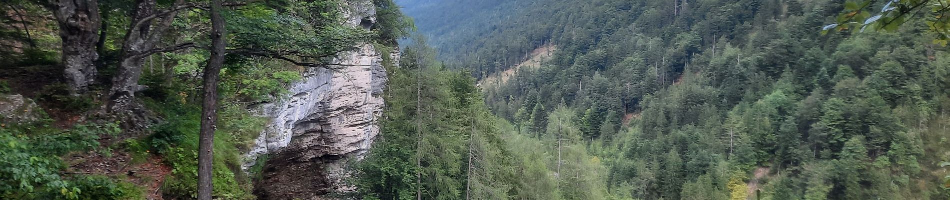
pericnik excursion

blechanteur
User GUIDE
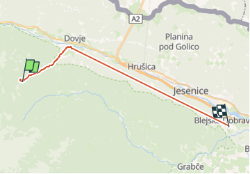

Length
19.3 km

Max alt
1179 m

Uphill gradient
1214 m
Km-Effort
36 km

Min alt
574 m

Downhill gradient
1408 m
Boucle
No
Creation date :
2025-07-11 17:28:23.692
Updated on :
2025-07-11 18:35:10.275
1h06
Difficulty : Easy

FREE GPS app for hiking
 SityTrail
IGN / Geographical institutes
SityTrail Plus
The world is yours!
About
Trail Walking of 19.3 km to be discovered at Unknown, Unknown, Kranjska Gora. This trail is proposed by blechanteur.
Description
montée à la cascade comme des touristes : arrêt au parking puis sentier qui grimpe ds la forêt
Photos


Positioning
Country:
Slovenia
Region :
Unknown
Department/Province :
Unknown
Municipality :
Kranjska Gora
Location:
Unknown
Start:(Dec)
Start:(UTM)
415121 ; 5143327 (33T) N.
Comments